![]()
![]()
![]()
![]()
46. Amble
start: Alnmouth
distance: 26 miles
OS map: 81
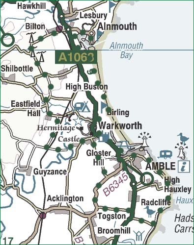 A fine stretch of coastline. There's a beach but this can be avoided if you'd prefer. We take in the impressive Warkworth Castle and Amble gives views out to Coquet Island. The return route is inland via a ford - you might get wet feet depending on conditions, but there's a footbridge if things are really grim.
Start in Alnmouth and take the road out of town to pick up the cycle route alongside the main A1068 heading S for a mile or so. You're looking for a track on the L (241 094) heading towards the beach. If you're game for two miles of sand then you need to force a route through the dunes; otherwise take the landward track.
Cycling the beach, you're looking for an exit by a golf course - there's an orange lifebelt on a post. If you're on the track, then it may not be possible to get as far as the golf course without nipping up to the main road. In any event you should head into Warkworth, a twee kind of place dominated by the castle. Plenty of shops, pubs etc.
We're stuck with the main road for a while aiming for Amble; look for a path on the L as you approach the marina - it'll get you off the road and go straight into town. Plenty more shops and pubs. Try to pick the coast road out of town. You'll pass a lonesome looking spire surrounded by a small graveyard. Apparently there used to be two chapels of rest, one either side of it...one was for catholics, the other for protestants. Some things never change...
Stick to the cliff path until you need to use the road; it turns into a track, then singletrack as you get into Druridge Bay Country Park. Turn R inland at Hadston Carrs. At the main road go R then L towards Togston. Turn R for Amble at the B6345 then L on a minor road towards Warkworth. You'll come to a T junction by a cricket pitch. Turn L for 500m then look for Watershaugh Road on the R entering leafy suburbia. Follow it round to the L then down to cross the ford.
Carry on uphill past a caravan site, over the railway and turn R. Turn L at the T junction to pass Eastfield Hall, then R to Low Buston and on to a junction at (225 087). Go L then R and past some sort of RAF installation guarded, it says, by geese...;-)
Turn R at the junction and you've a breeze of a run down to Alnmouth. As you cross the main Duchess Bridge you can take a path on the R called the 'Lover's Walk' which takes a more scenic route into town.
jb, galashiels
Download GPS data in GPX format.
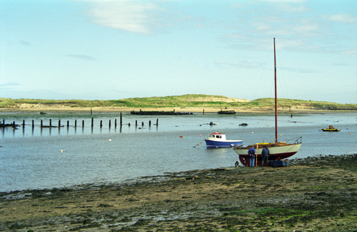
Coquet estuary, Amble
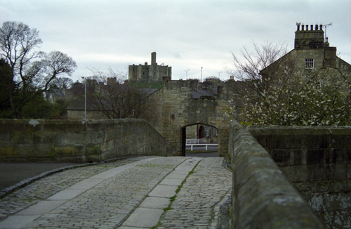
Warkworth
![]() back
back
![]() next
next
![]() home
home
![]() map and routes
map and routes